
North Charleston Neighbors Block Record Sources
The first question for North Charleston neighbors is which county governs the parcel. The city spans Charleston, Berkeley, and Dorchester Counties. Start with the county parcel viewer, not the city mailing name, then read each adjoining parcel as its own record. Public property tools show land-record evidence, while historic library material can show a dated listed occupant. Neither source produces a complete household roster for a block.
| Block source | What it can show nearby | Access route |
|---|---|---|
| County Parcel Viewer | Parcel geometry, adjoining polygons, owner and deed or plat clues | County GIS map, after county confirmation |
| Property record card | Parcel ID, recorded owner, situs and mailing distinction, legal description | County property search, one parcel at a time |
| Register of Deeds and plats | Recorded title and subdivision references for a parcel | Correct county index, counter, or historical material |
| CCPL street directories | Historical listed occupants and nearby street entries | 1840 and 1890 onward street indexes, with locality checks |
| City permits or code files | Defined project or municipal case connected to an address | Customer Portal or a bounded City FOIA request |
| Voter record access | Individual registration information subject to statute | Individual portal or county inspection, not a street roster |
A property owner, a tax-mailing contact, and a person listed in an old directory are three different kinds of evidence. Each may be useful in its own time and setting. None alone proves that a particular person is a current North Charleston neighbor. Keep the source and date attached to every note.
Note: An address can use a North Charleston mailing name while its controlling parcel record belongs to a different county system.
North Charleston Parcels Set the Block
County selection controls every next step. In Charleston County, the Parcel Viewer accepts an address, road, parcel number, or owner. Berkeley County has its own GIS, and Dorchester County directs searches to its TMS and parcel information. The map boundary and parcel ID are stronger starting points than a ZIP or a neighborhood label.
Charleston County's layers include parcels, street and address points, building footprints, hydrology, and jurisdictional boundaries. Measures can help understand distance or area, but they do not certify a boundary. A selected parcel's ID can lead to tax information. For a North Charleston block that reaches a county edge, open the correct county viewer for each side rather than assuming one portal covers every lot.
Park Circle offers a useful historical mapping clue because its curving, radial plan grew from an early planned development. That geometry can help orient a historical plat or directory entry, but a legal description, parcel ID, or recorded plat is still needed to identify land. North Charleston's 1972 incorporation also means older records may use Charleston Neck, Navy Yard or parish labels instead of the present municipal name.
Map a North Charleston Block
Work outward from one confirmed address. The goal is to understand the physically adjoining parcel records, not to build a list of nearby people. Each polygon can have a different ownership structure, transfer date, mailing contact, or county pathway. On an old subdivision, compare the map with the legal description and plat book or deed reference before deciding that two lots are the same historic place.
- Find the target address in the parcel viewer for the correct county and select its polygon.
- Record the parcel ID, visible owner field, deed or plat references, and jurisdiction from the selected record.
- Select each physically contiguous polygon and open its own property card or county record. Do not copy a target parcel's details onto an adjoining parcel.
- Use a recorded deed or plat only when the parcel ID, legal description, and date line up. For a full named-street trail, switch to the North Charleston Street Directory.
The same method works in Berkeley and Dorchester County after the county is confirmed. County cards, plat references, and deeds often span different online time ranges. An apparent gap in a web viewer is a reason to use the county office's counter, archive, or Register of Deeds channel for the identified parcel, not a reason to guess.
North Charleston Parcel Popups Explained
A Charleston County selected-parcel popup can display a Parcel ID, owner, deeded acreage, plat book and page, deed book and page, and jurisdiction. That information is a compact location record. The Parcel ID can link to tax information, while a book and page can seed a Register of Deeds search. Read the popup as a pointer to a record trail, not a final statement about the people on a block.
| Parcel field | Why it matters for nearby parcels |
|---|---|
| Parcel ID or TMS | Connects map selection to the county card and deed reference. |
| Owner | Identifies the recorded property party, not every occupant. |
| Deeded acreage | Helps compare a map polygon with the recorded parcel. |
| Plat book and page | Points to a subdivision or plat reference that may explain boundaries. |
| Deed book and page | Seeds an individual recorded-document search. |
| Jurisdiction | Helps check which public body appears in the record. |
The Charleston County Property Record Cards search supports name, address, TMS, and sales-date routes. Its cards distinguish property and mailing addresses and can show current owner fields alongside owners as of January 1. Reconcile those fields before assuming a recent transfer. Basic online deed transfers are complete to 1991; earlier clues can require a Card Image or a Register of Deeds follow-up.
The official property-search screen is the documented parcel-card route for a North Charleston neighbors search.
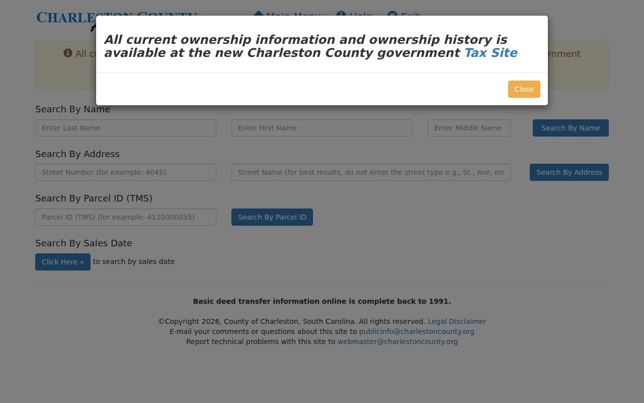
Use one card per parcel and preserve its date context, especially where transfers are recent or a mailing address differs from the property address.
North Charleston Voter Records Have Limits
South Carolina registration records are public inspection records under S.C. Code Ann. §7-5-410, but that does not turn the voter system into a web roster of North Charleston neighbors. The South Carolina voter portal supplies an individual route for registration, sample-ballot, polling-place, and voting-history information. The dynamic public capture did not establish a name-by-street browsing tool, and none should be implied.
Social Security numbers are not open for inspection under §7-5-170. Data confidential at the source remains confidential in the statewide database under §7-5-186. Section 7-5-321 allows a qualifying elector to keep residence address, telephone, and email confidential. Voting history records elections in which a person participated, not choices on a ballot. For a targeted historical poll-book question, ask the relevant county board or examine SC Archives and CCPL catalogs by county, precinct, and period.
Note: A public-inspection statute and an individual portal do not authorize a street-by-street list of nearby registered voters.
North Charleston Community Listings Stay Voluntary
No verified city-maintained North Charleston association or member-directory inventory was found in the research. The City website and FOIA department list are useful for contacting the appropriate municipal department, but they do not establish a household directory. Park Circle, Liberty Hill, Charleston Heights, Whipper Barony, and former Navy Base areas appear in local historical material as place names. That history does not prove a current association, membership list, or person at an address.
| Community information source | Appropriate use | Boundary |
|---|---|---|
| City department contact | Ask about an existing city-recognized program or record | Use a focused request; exemptions and redactions may apply. |
| Voluntary organization contact page | Reach an organization through information it chose to publish | Do not treat officer or contact data as a member roster. |
| CCPL local-history material | Interpret a place name, historic street, or neighborhood development | Historical location is not current household evidence. |
| City FOIA portal | Request a defined existing municipal record by address or date | Not a residents search and not a substitute for a directory. |
The City of North Charleston's official department route is a starting point for organization-level information or a correct public-records contact.
The official city route helps identify a department, while any request should remain limited to an existing record and should not seek private household details.
North Charleston Historic Block Context
For a historic block, CCPL's South Carolina Room and Charleston Archive add a dated community layer. The library holds directories, maps, microfilm, clipping files, and research databases. Reverse or street directories have an exceptional 1840 cross-reference and street listings from 1890 onward. North Charleston and Navy Base addresses may appear in separate outlying sections in 1940s and 1950s volumes, so an absence from the main Charleston sequence is not enough to rule out a household.
Older North Charleston records can sit under Charleston County, Charleston Neck, St. Philip Parish, St. James Goose Creek Parish, Navy Yard, Base, or an earlier subdivision label. CCPL's history of Park Circle begins with a 1912 development scheme, while the present City incorporated in 1972. Compare historical labels with plats, maps, and neighboring directory entries. Never force a modern city label or street number onto an older record without a parcel or legal-description bridge.
The Charleston County Public Library city-directories collection supplies the catalog route for dated directory research about North Charleston neighbors.
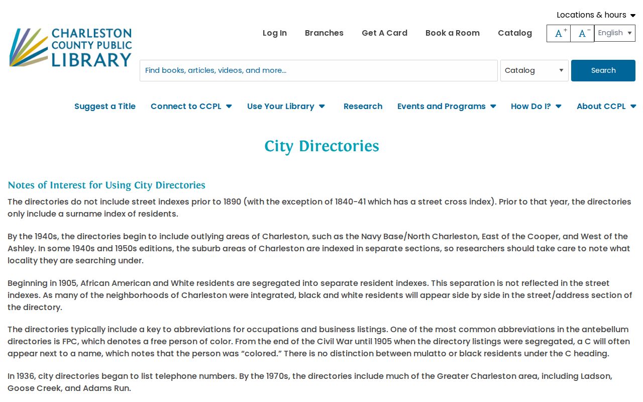
Use the collection's date and locality details alongside a parcel or map reference before treating a listed name as evidence for a particular historic block.
Charleston County's Register of Deeds keeps physical books from 1719 through 1960 and film or microfiche for 1960 through 2005, while its online deed and mortgage index begins in 1978 and images begin in February 1997. The counter and historical material are therefore part of a deep block trail, not an optional last resort.
North Charleston Neighbors Evidence Compared
Official records and commercial neighbor tools serve very different purposes. An official map or card identifies the custodian and the particular parcel behind a visible fact. A commercial profile can combine older records from uncertain dates and sources. Neither type of result proves a complete current household, but the county record gives a reader a direct route to check its source.
| Official county route | Commercial neighbor category | Best reading practice |
|---|---|---|
| Parcel-specific, with a county custodian and map or card context | May combine delayed, duplicated, or misattributed information | Check the parcel ID, record date, and named custodian. |
| Has defined access channels such as web index, counter, or archive | May not identify the source document or its date | Return to the official source before relying on a claim. |
| Shows a recorded property relationship | May present a broad profile without parcel context | Do not convert either into a household list. |
Lawful Limits for North Charleston Neighbors
Private household information belongs outside a block search. Parcel cards do not establish every occupant. City project records can name an applicant, owner, contractor, or agent rather than a person who lived there. Protected voter information, Address Confidentiality Program records, juvenile and sealed court material, DMV records, utility data, and delivery data are not a legitimate path for identifying North Charleston neighbors.
South Carolina's Address Confidentiality Program, S.C. Code §16-25-130, provides eligible participants with a substitute government mailing address for state and local agencies and courts. It has operated since 2025. A mismatch can be lawful and safety-critical. The program does not erase old public records, but its protections must never be circumvented. Report a sensitive identifier that appears unredacted to the record custodian rather than sharing it.
Lawful use. Use North Charleston neighbors research for lawful personal context, local history, or understanding a parcel record. Do not use public records to stalk, harass, intimidate, monitor, or harm anyone.