
North Charleston Delivery Area Coverage
A City police-assessment report records seven ZIP codes among North Charleston community respondents: 29405, 29406, 29418, 29419, 29420, 29456, and 29485. That is a useful local starting list, not an official municipal-boundary map or a complete validation for every delivery address. USPS assigns ZIPs for mail routing. The county that contains the parcel determines the property card, deed office, probate court, and many other record routes. Confirm the exact address before deciding that a particular ZIP leads to a North Charleston record system.
| ZIP | Areas Covered | Post Office | Notes |
|---|---|---|---|
| 29405 | Park Circle and Charleston Neck to North Charleston area | Charleston or North Charleston delivery area, verify address | Includes Leeds Avenue detention-center reference; county controls parcel records. |
| 29406 | Upper North Charleston reference, including City Hall | North Charleston delivery area, verify carrier route | City Hall reference does not make every address a city parcel. |
| 29418 | Airport and Dorchester Road west or southwest reference | Charleston-area delivery, verify address | Can cross municipal and county contexts. |
| 29419 | North Charleston mailing, post-office-box, or service-area reference | Facility type not verified in the research | Do not use as proof that a property is in the city. |
| 29420 | North Charleston and Summerville-side reference | Facility detail not verified in the research | May meet Dorchester or other jurisdictional geography. |
| 29456 | Goose Creek and northern North Charleston service-area reference | Facility detail not verified in the research | Mailing locality can differ from municipal jurisdiction. |
| 29485 | Summerville and Dorchester-side reference with a North Charleston connection | Facility detail not verified in the research | The city report does not establish every address as North Charleston. |
Use the official USPS ZIP Lookup for a particular address. It verifies the delivery form before a county or city record search begins.
The USPS address lookup is the official first check for a North Charleston delivery-area search.
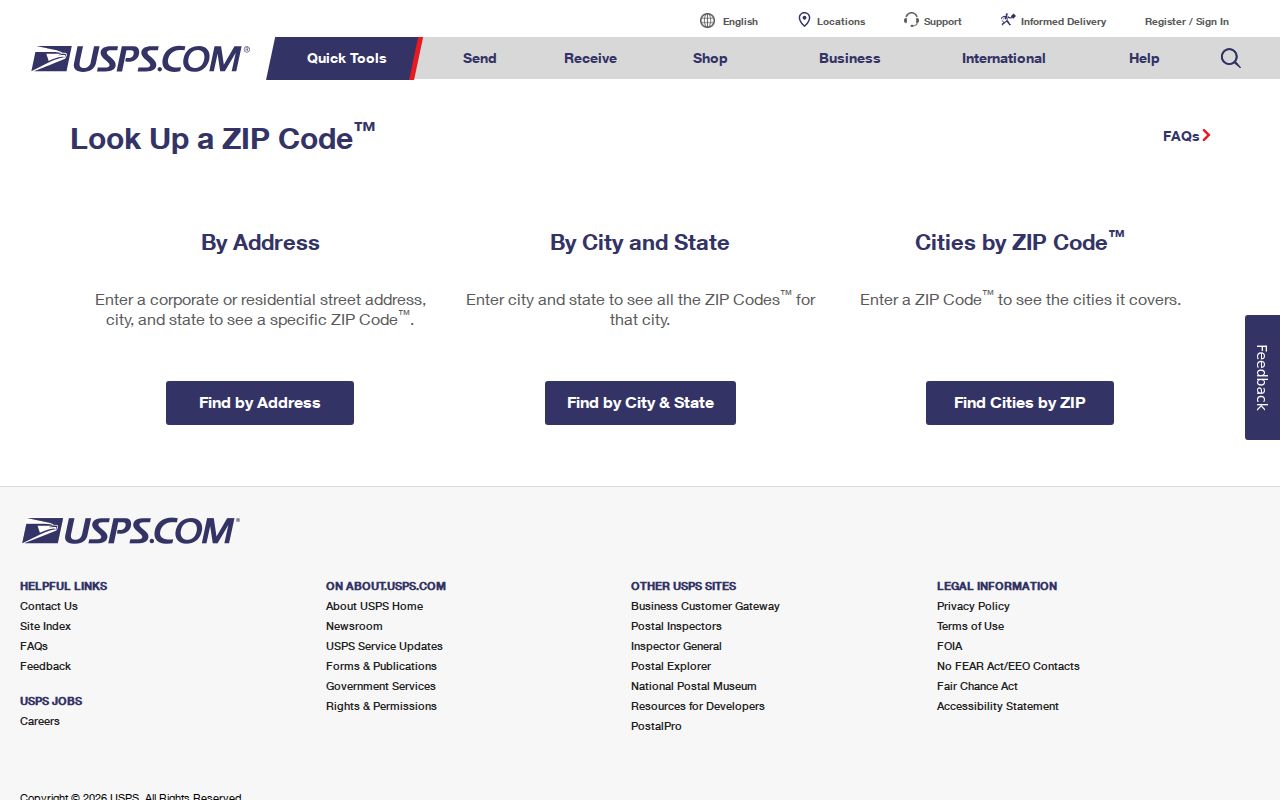
Its result is a delivery reference, so follow it with a county and parcel check rather than treating it as a city-limit decision.
North Charleston ZIP Geography
These delivery zones are routing geography. They are not city limits, precincts, tax districts, legal descriptions, or county boundaries. North Charleston has territory in Charleston, Berkeley, and Dorchester counties. A North Charleston mailing address may lie outside the city, and an address within the municipal footprint can use a ZIP whose preferred mailing locality sounds like another city. That creates the central rule for records work: USPS verifies mail delivery, while the parcel county selects the assessor, Register of Deeds, and court or probate path.
The City of North Charleston is a current municipal reference, but historic or parcel research requires the property’s own jurisdiction. Park Circle, Liberty Hill, Navy Yard, Charleston Neck, parish labels, and the 1972 incorporation date can affect older records as well. North Charleston was not a single historic county-seat records jurisdiction. The county name and TMS parcel identifier are more dependable record keys than a ZIP alone.
The North Charleston municipal site provides present-city context; use the verified address for the actual record jurisdiction.
Municipal information is useful background, while the parcel record identifies which county system applies to a property.
North Charleston Delivery Verification
Start with the complete street address. Run it through USPS, then identify the parcel county before opening a property system. Charleston County offers Property Record Cards and a Parcel Viewer. Berkeley County has its own Assessor property search and GIS. Dorchester County has a CAMA real-property and mobile-home inquiry plus county map resources. These are separate public systems because the city spans all three counties.
- Enter the full delivery address in the USPS lookup and save the returned ZIP form.
- Determine whether the parcel is in Charleston, Berkeley, or Dorchester County.
- Use that county’s address, owner, or TMS parcel route to locate the property card or map.
- Compare the situs address, legal description, and parcel identifier before using a deed reference.
- Use the correct county Register of Deeds for a recorded document, not the ZIP or mailing-city label.
For a narrow address sequence after county confirmation, the North Charleston street directory lookup explains the property-card and deed path by street.
Note: A verified ZIP identifies mail delivery, while a parcel county identifies the public office and database for land records.
North Charleston Parcel Search Fields
No local county assessor or GIS portal was documented with a ZIP-wide property filter. Charleston County Property Record Cards use name, address, parcel, and sales-date routes. Its Parcel Viewer accepts an address, road, parcel number, or owner name. Dorchester’s CAMA system uses tax year, TMS or account number, owner, street, and mobile-home fields. A ZIP can help verify a known address, but it does not produce an official roster of every person or parcel within a delivery zone.
| Charleston property-card field | How it works after address verification |
|---|---|
| Enter Last Name | Required for the name route. Partial last name is accepted without punctuation. |
| Enter First Name | Optional narrowing field for the name route. |
| Street Number | Optional. Pair it with a street name for an address route. |
| Street Name | Required for the address route. Omit the street type and spell numbered streets as words first. |
| Parcel ID, TMS | Required for the parcel route. Enter ten digits, optionally followed by A or B, with no punctuation. |
| Sales Date | Available through a separate linked search route. |
The Charleston County Property Record Cards are free public lookup tools. A result can identify a taxable parcel and recorded owner, not everyone who lives at an address.
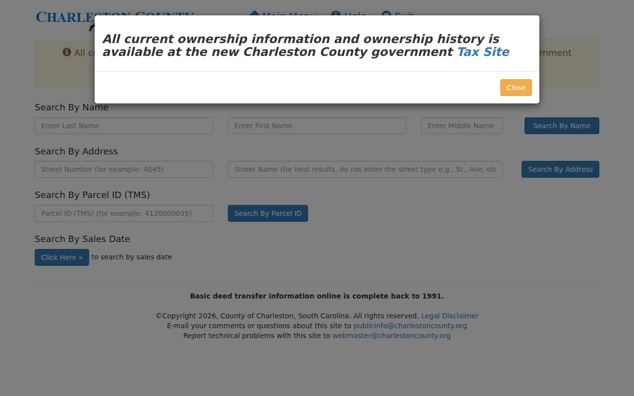
The address and TMS fields show why a confirmed parcel path is stronger than a ZIP-only search.
North Charleston ZIP Record Steps
Finding a record within one delivery zone is an address-by-address task, not a bulk resident list. After USPS and county confirmation, Charleston County’s property-card portal can search a street name and return street number, current owner, owner as of January 1, and TMS fields. The Parcel Viewer can then connect an address, road, parcel, or owner search to a parcel polygon and property-card link. Berkeley and Dorchester require their own county portals after the county is resolved.
Property information identifies recorded ownership and taxable parcels. It does not establish current occupants, renters, or household members. South Carolina’s voter portal is an individual self-service route, not a street or ZIP browse. County registration records are public inspection records under S.C. Code Ann. §7-5-410, but protected and confidential data remains protected. A request or counter visit should be directed to the right county and should describe a lawful, specific record need.
Charleston County’s Parcel Viewer provides the map route after an address has been placed in the correct county system.
North Charleston ZIP Boundaries
29405, 29406, and 29418 are useful local references, but none supplies a shortcut around jurisdiction checks. The 29405 row includes a Park Circle and Charleston Neck to North Charleston reference as well as a Leeds Avenue detention-center address. 29406 has a City Hall reference. 29418 reaches the airport and Dorchester Road area. Those facts describe practical delivery geography, not a legal boundary line. The 29420, 29456, and 29485 rows add Summerville, Goose Creek, and Dorchester-side contexts where mailing place can be especially misleading.
- ZIP versus ZIP+4
- A ZIP identifies a delivery area. ZIP+4 adds a more specific mail-routing segment and does not replace a parcel identifier.
- Post-office-box ZIP
- A ZIP used for box or service-area mail. It is not proof of a property’s physical jurisdiction.
- Unique ZIP
- A delivery designation tied to one organization or facility. None was verified for North Charleston in the research.
- Carrier route
- The local postal delivery route within a ZIP. Verify it with USPS for the precise street address.
Note: The City report’s seven ZIP list is a local reference list, not evidence that every listed delivery address lies in North Charleston.
North Charleston ZIP Parcel Keys
Once the proper county is known, match the address to the record key used by that county. A situs address is the physical location of the taxable parcel. A mailing address is where a tax notice was directed and may be a post-office box, agent, business address, or another city. The legal description records lot, block, subdivision, plat, or metes-and-bounds terms. A TMS or parcel ID is the county-specific identifier that joins a property card, GIS result, and deed reference.
Charleston County expects a ten-digit TMS number, with an optional A or B suffix and no hyphens, dashes, or spaces. Its property-card results can distinguish a current owner from an owner as of January 1. Recent transfer timing can make those fields differ. Treat each as date-specific recorded information, not proof of a person’s present residence. The deed record, legal description, and county map are the better checks when address labels change.
North Charleston ZIP History Labels
Modern delivery labels do not travel backward cleanly through local history. North Charleston incorporated in 1972, and historic materials can instead be cataloged under Charleston, Charleston Neck, Navy Yard or Base, St. Philip Parish, St. James Goose Creek Parish, Berkeley County, or Dorchester County. CCPL says the directories began covering outlying Navy Base and North Charleston areas by the 1940s. A 1940s or 1950s directory may place those addresses in a separate suburban section.
For older properties, compare the parcel legal description, plats, historic maps, and directory street indexes rather than forcing a present ZIP or city name into an earlier record. CCPL documents an 1840 cross-reference and street listings from 1890 onward. Its historic-property material reaches maps from the 1670s through the 1990s. That layered approach is more reliable than treating a postal code as a lasting place identity.